Nature
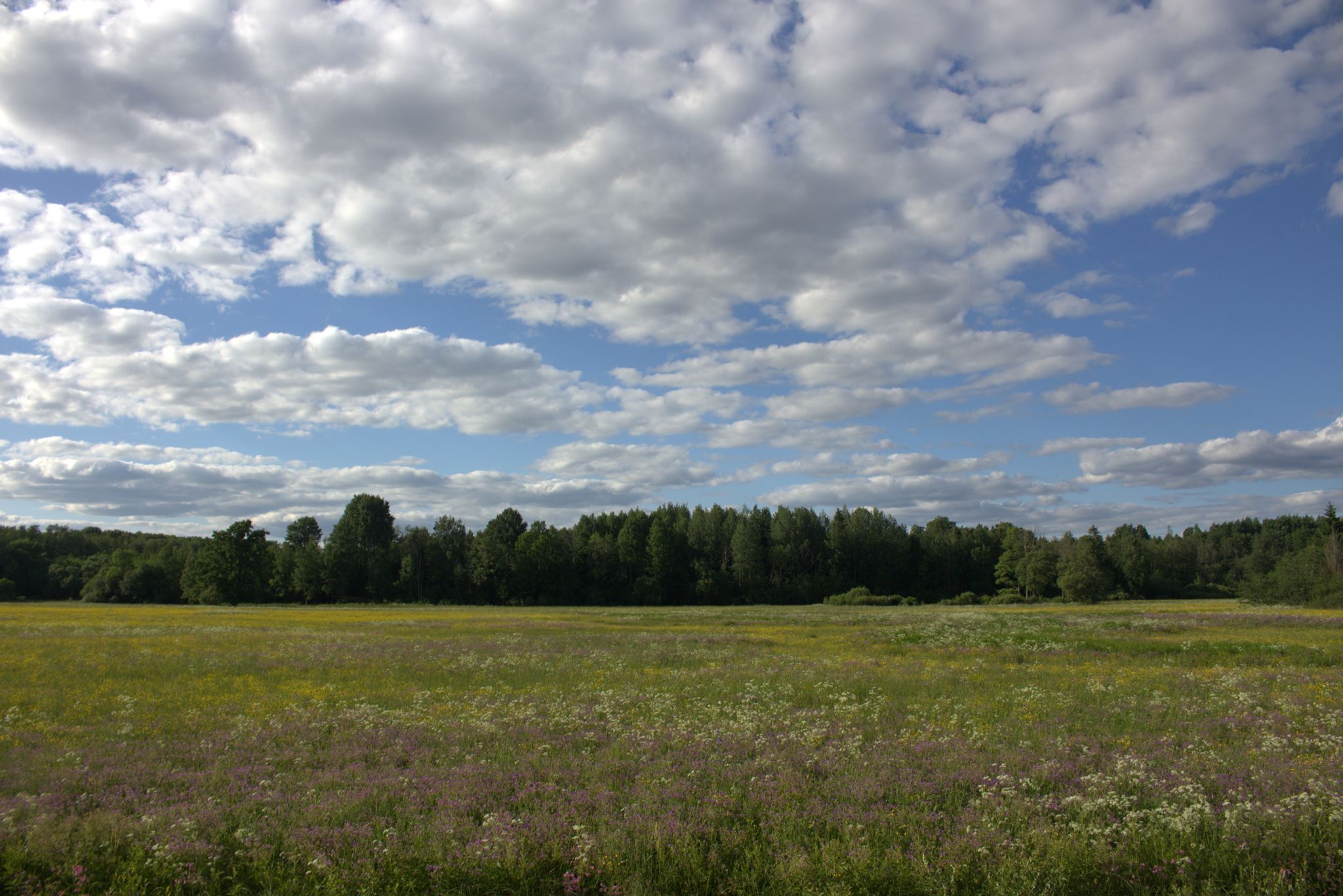
The terrain of the Soomaa National Park is relatively flat, but habitat to diverse lifeforms. Over 80% of the protected area is made up of wetlands.
Bogs
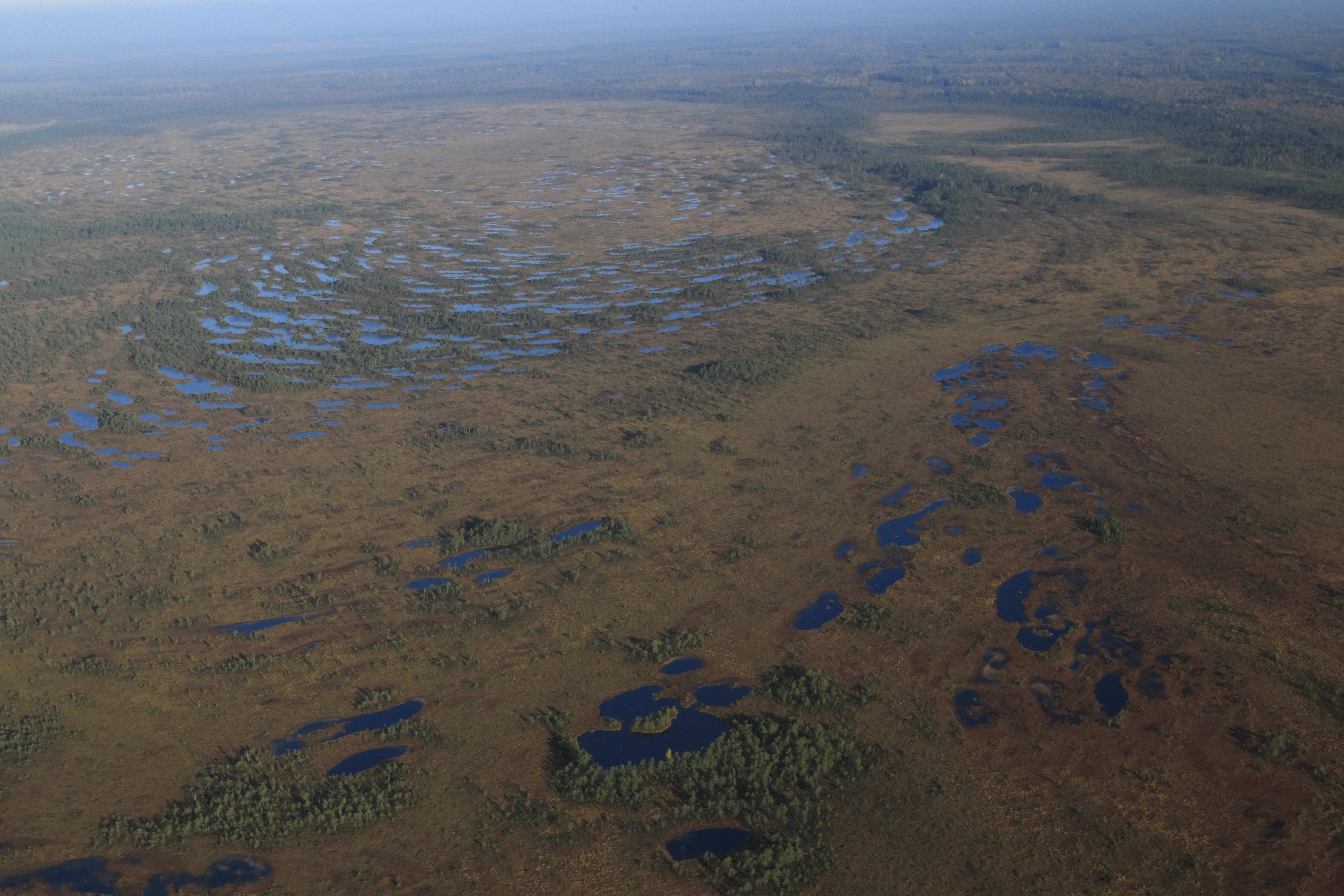
The bogs of the Soomaa National Park began to emerge about 13,000 years ago after the area was released from the continental shelf. As a result of melting ice, a large lake formed on the edge of the present-day Pärnu and Viljandi counties, leaving behind several water bodies in the lower basins that have over thousands of years developed into bogs with thick layer of peat. To date, the bogs have developed into marshes.
The main part of the National Park consists of five unique bogs: Kuresoo, Öördi, Kikepera, Valgerada and Riisa bog. Due to the accumulation of peat, their surface has risen by up to 6 meters higher than the surrounding mineral soil.
Bogs are the habitat of protected species as the golden eagle (Aquila chrysaetos). Additionally, you may encounter common crane (Grus grus), European golden plover (Pluvialis apricaria) and jack snipe (Lymnocryptes minimus) In autumn, the bog areas are a stopover for geese and cranes, migrating horned grebe (Podiceps auritus) and common kestrel (Falco tinnunculus). In bog ridges and ponds one can watch the mating display of Western capercaillie (Tetrao urogallus) and in the spring one hears the characteristic mating sounds of black grouse (Tetrao tetrix).
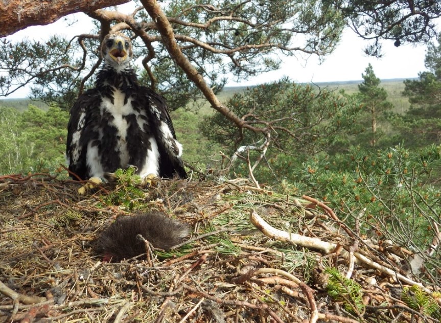
Young golden eagle (Aquila chrysaetos) is in the nest. Photo: Gunnar Sein
The biggest peatland in Soomaa is Kuresoo (11,000 ha). In the southern part of the bog is Estonia's highest and steep bog slope. Kikerpera bog (6,900 ha) that is located in a long and flat basin has developed as a result of the paludification of the lake and has many bog ponds, bog cavities and morass. Öördi bog (4910 ha) was created when a large deep-water lake paludified. Its peat layer is up to nine and a half meters thick. The only inland water body that has remained from this once huge lake is Öördi which covers about 4 hectares and is 3 to 4 metres. Covering 2,500 ha, Valgeraba is the oldest bog in Soomaa and has the thickest peat layer (11 m). The smallest bog is Riisa (830 ha), developed as a result of the paludification of mineral soil.
Bog Valgeraba. Photo: Mati Kose
Rivers
The landscape of the national park is criss-crossed by five rivers: Halliste, Kõpu, Lemmjõgi, Navesti and Raudna rivers.
When the water from rainfall or melting snow flows downward from the Sakala Upland, the small rivers of Soomaa running mainly on plains will overflow and create huge floods. These floods have their own name in Soomaa - "the fifth season". The flood which may occur at any time of the year, but most often it takes place in the spring, can last from a few days to a few weeks. At maximum water height, 17,500 hectares in the lower reaches of the rivers can be flooded.
Of semi-aquatic mammals, the rivers feature beaver (Castor fiber), otter (Lutra Lutra) and mink (Mustela vison) 17 species of fish have been found in the rivers, of which the most common are pike (Esox lucius), common roach (Rutilus rutilus), common bleak (Alburnus alburnus) and perch (Perca fluviatilis).
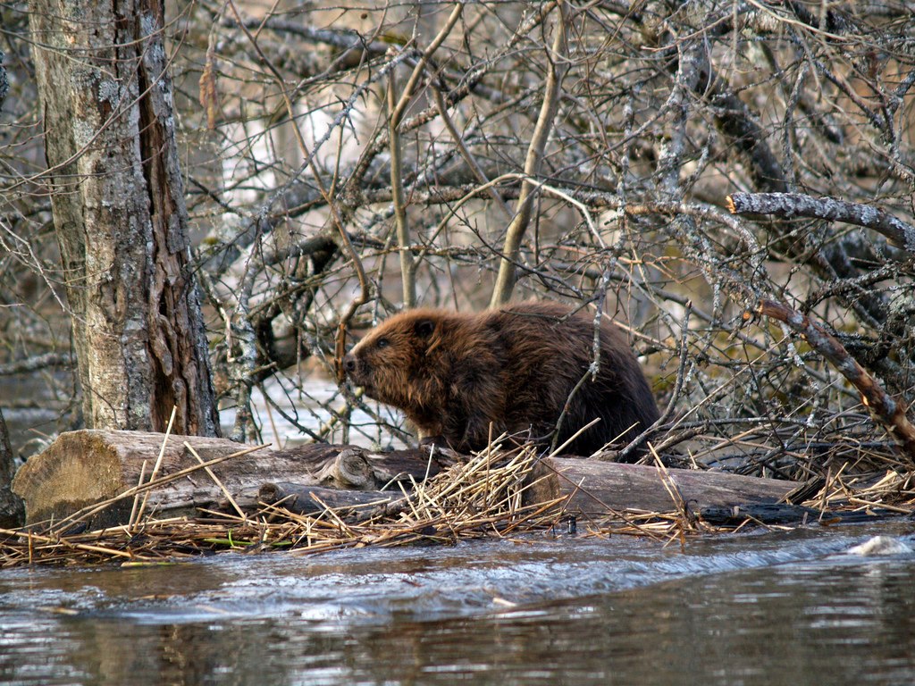
Beaver (Castor fiber). Photo: Aivar Ruukel
Floodplain grassland
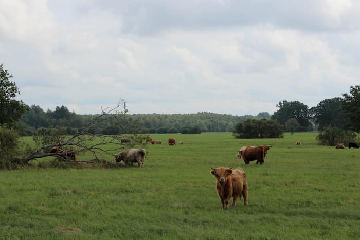
The flooded areas of the rivers are covered by species-rich floodplain grasslands that have a total area of around 1,500 ha. They have traditionally been used for growing hay and for grazing. Today, hay is harvested on about 700 hectares.
The largest floodplains are Tipu, Läti and Tõramaa, Kuusekäära on the Raudna River and Mulgi hayland and Oksa floodplain on the shores of Lemmjõgi. In order to avoid turning floodplain grassland into scrubland, they must be regularly mowed or grazed.
Floodplain Kuusekäära. Photo: Aivar Ruukel
Flooding brings additional nutrients to floodlplains which explains their lush vegetation. Here you can see the Siberian iris (Iris sibirica), Turkish marsh gladiolus (Gladiolus imbricatus) and several orchids (Orchidaceae) Since ancient times, the shares of the Halliste river has had oak forests, forming the picturesque Tõramaa wooded grasslands.
Floodplain Tõramaa. Photo: Krista Kingumets
Forests, animals and birds
Forests form nearly half of the Soomaa territory. Characteristic forest types are are peatland forests, spruce bogs forests spreading on the edge of bogs, mesotrophic boreal forests and floodplain forests covering several hundred hectares of river floodplains. The most common tree species are of pine (Pinus sylvestris), birch (Betula) and black alder (Alnus glutinosa)
Local forests are the habitat for such large predators as lynx (Lynx lynx), grey wolf (Canis lupus) and brown bear (Ursus arctos) as well as our indigenous species elk (Alces alces) and European roe deer (Capreolus capreolus). In swamp and floodplain forests one can see black stork (Ciconia nigra), Ural owl (Strix uralensis), Boreal owl (Aegolius funereus), black woodpecker (Dryocopus martius) and Eurasian three-toed woodpecker (Picoides tridactylus)
Floodplain forests are forests periodically flooded by rivers. In floodplain forests which have become a rare forest type in Estonia features such broadleaved trees as oak (Quercus robur), linden (Tilia cordata), ash (Fraxinus excelsior), white elm (Ulmus laevis) and wych elm (Ulmus glabra). The most typical floodplain forests are Pääsma, Karukose and Lemmjõe. Vegetation under the forests is rich and includes ramsons (Allium ursinum), Solid-tubered Fumitorys (Corydalis solida) and Mercurialis perennis. Of rarer birds there are white-backed woodpecker (Dendrocopos leucotos) and middle spotted woodpecker (Dendrocopos honey). Further from river floodplains where floods are less frequent are swamp forests on damp ground. Of the vegetation one should mention pale yellow iris (Iris pseudacorus), violets (Viola uliginosa), marsh marigold (Caltha palustris) and tufted loosestrife (Lysimachia thyrsiflora).
Drier mineral plains are covered by mesotrophic boreal forests. Typical for Soomaa's mesotrophic boreal are old powerful European aspens (Populus tremula) In the southeastern corner of the protected area, in the lakeside dunes of the former Baltic ice dam, the terrain is characterised by dry and open heath and floodplain forests with prairie crocus (Pulsatilla patens) and Gypsophila fastigiata.
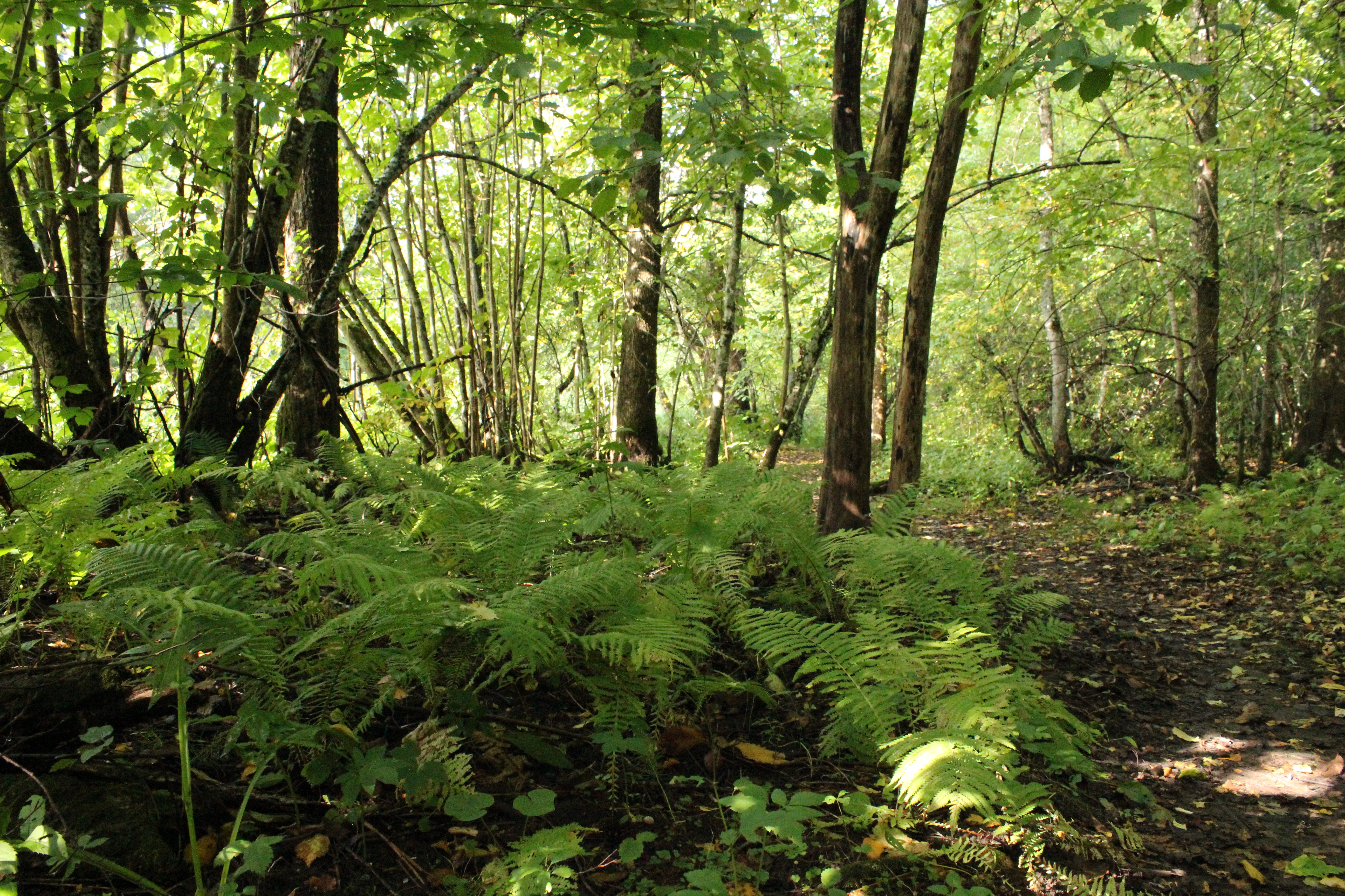
Alluvial forests are periodically flooded by rivers. Photo: Krista Kingumets