Hiking trails and sigths
In eastern part of the nature reserve there are 3 hiking trails in bogs and forests.
Männikjärve hiking trail. Length 3 km, duration up to 1.5 hours. Marked with red spots on the trees, there are several information boards on the trail. The trail runs in the forest around the shallow Lake Männikjärv, its shore is partly quaking. Starts and ends from Tooma village, Endla Nature Centers parking place.
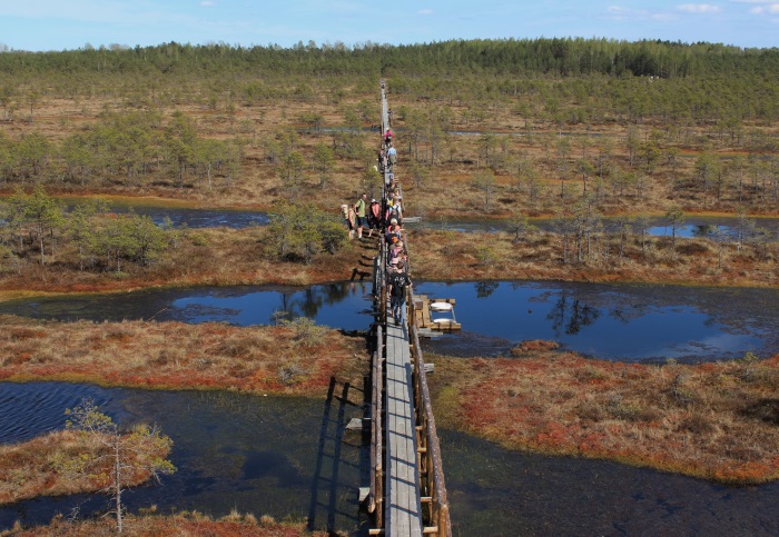
Männikjärve bog study trail. Length 7 km, duration 2.5–3 hours. Marked with blue spots on the trees, there are several information boards on the trail. Route: Tooma - Männikjärve bog - the Mustjõgi River - Lake Kaasikjärv - Lake Männikjärv - Tooma. Boardwalk leads through the Männikjärve bog, there is a 7 m observation tower in the middle of the bog. Nice views of the bog, the pools and hollows. The Mustjõgi River is a 2.5 km long river that joins Lake Tulijärv and Lake Endla. Bog restoration area can be seen by Lake Kaasikjärv. Lake Männikjärv is a small and shallow lake with a quaking shore. There are several observation points of Tooma mire hydrology station by the study trail. Upon high waters, part of the trail is wet or unpassable! Starts and ends from Tooma village, Endla Nature Centers parking place.
Lake Endla hiking trail. Length 8 km, duration 4–5 hours. Marked with yellow spots on the trees, there are several information boards on the trail. Route: Kärde - Lake Endla - Salu wooded meadow - the Mustjõgi River - Männikjärve bog - Tooma. On the way back, you can walk by Lake Männikjärv instead of the Männikjärve bog. The hiking trail runs along a versatile landscape – oligotrophic bog forests, Lake Endla with a shore covered with reed, swamp restoration area of the Kaasikjärve bog, drained peatland forests by the Mustjõgi River and mosaic Männikjärve bog. The trail has 1 viewing platform, several rest areas and bridges, partly covered with wood chips and boardwalk. There are several observation points of Tooma mire hydrology station by the hiking trail. Upon high waters, part of the trail is wet or unpassable! Many camping and fire possibilities.
In the western part of the nature reserve are the springs hiking trail.
Various springs can be visited by following the signs and information boards on the road between Norra and Jõeküla.
- Right by the gravel road there are the Valtri well and Oostriku springs.
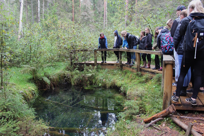
- A study trail covered with wood chips leads to the deepest spring of Estonia – Sopa spring, it is 450 m away from the road.
- Võlingi spring is 500 m away from the road, the hiking trail takes you through a wooded meadow, eutrophic boreo-nemoral forest and a boardwalk leads to the Vilbaste springs.
- Purskav allikas (Erupting spring ) is 700 m away along the Kirikumäe road.
Water trips, for example canoeing on the Põltsamaa River or boating on Lake Endla and Lake Sinijärv, may be done with a vessel without engine, but a permission of the Environmental Board is needed for that. Several campfire and camping sites have been intended for people on water trips.
Campfire and camping sites are located:
- in Tooma at the nature centre by Lake Linajärv,
- by Lake Endla in the estuary of Kärde ditch,
- by Lake Endla next to the log house (by Juta rock),
- in crossing of the Nava River and Räägu channel (W)
- on the Põltsamaa River in the estuary of the Nava River (Tammemäe Hill) (W),
- by Lake Sinijärv,
- in the Kirikumäe ride by the Põltsamaa River (W),
- by the Oostriku River near the spring,
- near the bridge of the Oostriku River in the estuary of Norra Creek,
- in the Võlingi wooded meadow.