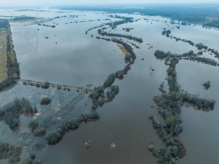
Exceptional flooding in the Kasari flood meadow
Автор:
Margit TurbOn 17 January, the water level of the Kasari river rose 228 cm above the zero level of the gauging station, flooding an extensive flood-meadow area downstream of the river. This year active snowmelt coincided with frequent showers already appearing in early January. Usually, the flood meadow is impressive during the spring snowmelt period, when high water levels persist for a few weeks.
The 4,000-hectare Kasari flood meadow is the largest in northern Europe. A flood meadow is an area of grassland on the floodplain of a river, subject to seasonal flooding. The waters of the Kasari and its tributaries that no longer fit into the riverbed periodically flood the area. Floodwaters bring nutrient-rich sediments that promote grass growth. To maintain the flood meadow, it needs to be consistently mowed or grazed on. The Kasari flood meadow is an important migratory stopover and breeding area for water and shore birds.
The Kasari flood meadow has been heavily influenced by the land reclamation works that took place between 1926 and 1940, when Kasari and its tributaries were dug into straight canals downstream. From the observation towers of Kloostri and Penijõe, you can clearly see that the rivers at the delta of Kasari follow an unnaturally straight course. This has shortened the time and reduced the extent of flooding.
According to folklore, people living near the flood meadow need to fear two men – the Vigala and the Matsalu Man. The ‘Vigala Man’ is the flooding that occurs during heavy rainfall, which is fed from the upstream of the river. The ‘Matsalu Man’ occurs when there are strong westerly winds for a long time, which do not allow the water from the river to flow into the Matsalu Bay. In this case, too, the flood meadow will be flooded with the water that can no longer fits in the riverbed.
Operational data on the water level of Kasari can be found on the Kasari hydrometric station’s page of the Estonian Environmental Agency: LINK
